Measure stockpiles, earthworks, and material volumes with precision using drone captured data
Reliable • Safe • Lightning Fast
Why Airmatix Volumetrics Stand Out
Traditional volumetric surveys are often resource intensive, slow to deliver, and prone to human error.
We change that with advanced aerial photogrammetry and survey grade GNSS positioning, providing volumetric measurements accurate to within ±2-5 cm, depending on site conditions.
Survey Grade Accuracy
High resolution imaging combined with RTK/PPK GNSS correction for centimeter level precision.
Rapid Turnaround
From aerial capture to final deliverables in as little as 24-48 hours.
Unmatched Safety
No need for crews to enter unstable piles, active excavation zones, or hazardous environments.
Historical Comparisons
Monitor site changes over time with repeatable, consistent measurements.
Our Products
Industries We Serve
Precise drone powered volumetric data to improve accuracy, safety, and decision making
Construction & Earthworks
Monitor cut/fill operations, validate billing, and track material movement.
You receive GIS ready data, detailed reports, and web viewable outputs.
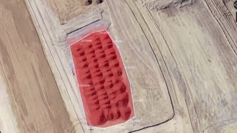
Core Outputs
Most Common Deliverables
Our volumetric deliverables provide high resolution maps, 3D models, and precise measurement reports, all formatted for GIS, CAD, and industry software, empowering your team with accurate, ready to use drone survey data.
2D Orthomosaic Maps (GeoTIFF, etc.)
Volumetric Reports with accuracy statements
3D Surface Models (DSM & DTM)
Stockpile Boundaries & Contours
Classified Point Cloud Data (.LAS/.LAZ)
Change Over Time Analysis for recurring surveys
Get Started
Whether you’re managing a construction site, quarry, agricultural facility, or landfill, our volumetric services help you measure smarter, quickly, safely, and affordably.
+0%
Data coverage per flight. Ensuring complete and consistent site documentation with minimal gaps.
0X
Faster han traditional methods. Drones drastically reduce field time and speed up project delivery.